Today, Tuesday 25th January 2022, the Department of Primary Industries and Regions (PIRSA) announced:
“Fishing is now temporarily prohibited around the recently constructed Glenelg and O’Sullivan Beach shellfish reefs for a 12-month period to allow the reefs and marine life to settle and develop.
The Department of Primary Industries and Regions (PIRSA) has implemented the temporary management arrangements under Section 79 of the Fisheries Management Act 2007.
PIRSA’s Acting Executive Director, Fisheries and Aquaculture Dr Shane Roberts said the latest management arrangements follows on from a similar ban which was implemented during the construction of Windara Reef off Yorke Peninsula.
“It’s essential the new reefs are protected to allow the limestone that was deployed and the marine life that will utilise the reef to settle and begin to develop for an extended period, to maximise the ecological value of the reef,” he said.
Department for Environment and Water Principal Marine Science, Simon Bryars, said shellfish reef habitats are important to the marine environment, along with fish breeding and quality, but they can also provide recreational and economic opportunities for the state.
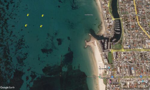
“The Glenelg Reef is a low-profile native oyster reef about one kilometre offshore in approximately seven metres of water within a five-hectare development area,” he said.

Glenelg
(Google Earth map annotated by Dan Monceaux)
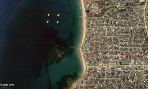
“At O’Sullivan Beach, construction has recently wrapped up on a five-hectare native shellfish reef about 500 metres offshore.

O’Sullivan Beach
(Google Earth map annotated by Dan Monceaux)
“O’Sullivan Beach was chosen as the next metro shellfish reef as it offers suitable environmental conditions with good opportunities for colonisation of marine species from the nearby rocky reefs. …… “
Glenelg Shellfish Reef closure coordinates:
34°58.314 S, 138°29.787 E
34°58.314 S, 138°29.955 E
34°58.422 S, 138°29.787 E
34°58.422 S, 138°29.955 E
O’Sullivan Beach Shellfish Reef closure coordinates:
35°7’42.93 South, 138°27’33.801 East
35°7’42.93 South, 138°27’43.758 East
35°7’49.394 South, 138°27’33.801 East
35°7’49.394 South, 138°27’43.758 East
For more information on fishing closures in South Australia visit www.pir.sa.gov.au/fishing/closures_and_aquatic_reserves


Good to hear that Simon Bryars is involved. I’d been wondering what he was doing lately.