When Matthew Flinders had finished surveying the southern coast of Australia in 1802, he continued sailing his ship, HMS Investigator northwards in an attempt to chart the rest of the Australian coastline. This became quite impossible for him since the Investigator was badly leaking seawater. In early 1803 Flinders had to sail the Investigator to Timor. When he left Timor, he sailed down the coast of Western Australia to make his way back to Port Jackson (Sydney). He sailed wide of the coast to save time for the journey back and was unable to survey and chart the coastline. He only made one stop on the way back. That was at Middle Island in the Recherche Archipelago off of Western Australia in May 1803. The archipelago had been named “L’Archipel de la Recherche” by France’s Rear-Admiral Bruni d’Entrecasteaux in 1792. It was named after one of d’Entrecasteaux’s ships, the Recherche. WA’s Esperance is named after his other ship, the Esperance. The Recherche Archipelago comprises some 105 islands and 1500 islets. Flinders had named Middle Island when he was first there in 1802. The island is situated about the middle of the Recherche Archipelago which stretches from west of Esperance to the Great Australian Bight. Middle Island is the largest island in the archipelago. Flinders had climbed Middle Island’s 165m high peak to its summit on 15th February 1802 to survey the surrounding waters. It is now called “Flinders Peak”. It overlooks the spectacular pink lake called Lake Hillier. The lake is saturated with salt and John Thistle collected some for the Investigator. John Thistle was the master on the Investigator. He was one of eight men who died only one week later at Memory Cove near Port Lincoln.
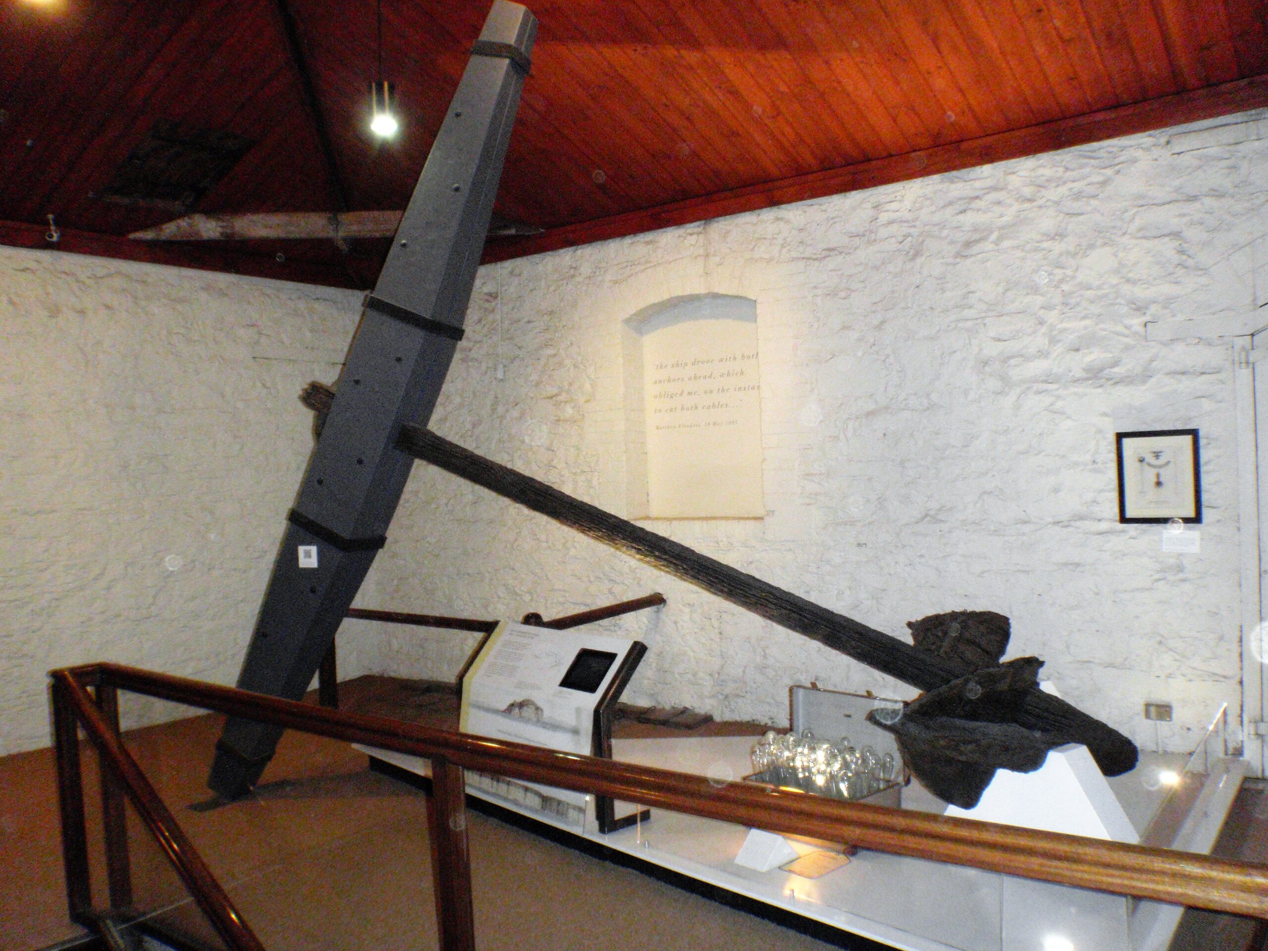
At daylight on 21st May 1803 Flinders was preparing to depart from Middle Island but a fresh breeze started driving the Investigator towards rocks before the sails were loosed. Flinders used the ship’s spare anchors to hold her. He then had to cut two anchor cables just before the ship cleared the rocks at noon. Flinders had lost both his best bower anchor and stream anchor. A bower anchor is one at the bow of the ship. The Investigator’s best bower anchor was over 4m long and weighed over 1 tonne. It had giant flukes sharply offset like a massive arrow. The stream anchor was much smaller, being 3m long and weighing about 406kgs.
In 1972 Doug Seton from the SA Museum organized an expedition with some of his fellow Underwater Explorers Club of SA members to find and raise the two anchors. They were both located in Goose Island Bay on 14th January 1973. The bay is so-called because Goose Island is situated in the bay, which is on the northern shore of Middle Island. The anchors were both raised up by the lighthouse ship Cape Don on 19th January 1973. They have now been preserved and restored. The best bower anchor is now located at the SA Maritime Museum at Port Adelaide. The stream anchor was placed in Canberra along with an anchor from James Cook’s Endeavour.
References
My references for this article included:-
- “Let’s Go for a Dive – 50 years of the Underwater Explorers Club of SA”, edited by Peter Christopher and Nicholas Cundell, 2004.
- “The Skindiver’s Underwater World” by Graeme R. Dodd, Fin-sport Publications, 1974.
- “Matthew Flinders” by Thea Stanley Hughes, Movement Publications, 1991.
- “A Hundred Islands in a Lonely Sea” by Howard Whelan, Australian Geographic No.27, July to Sep. 1992.