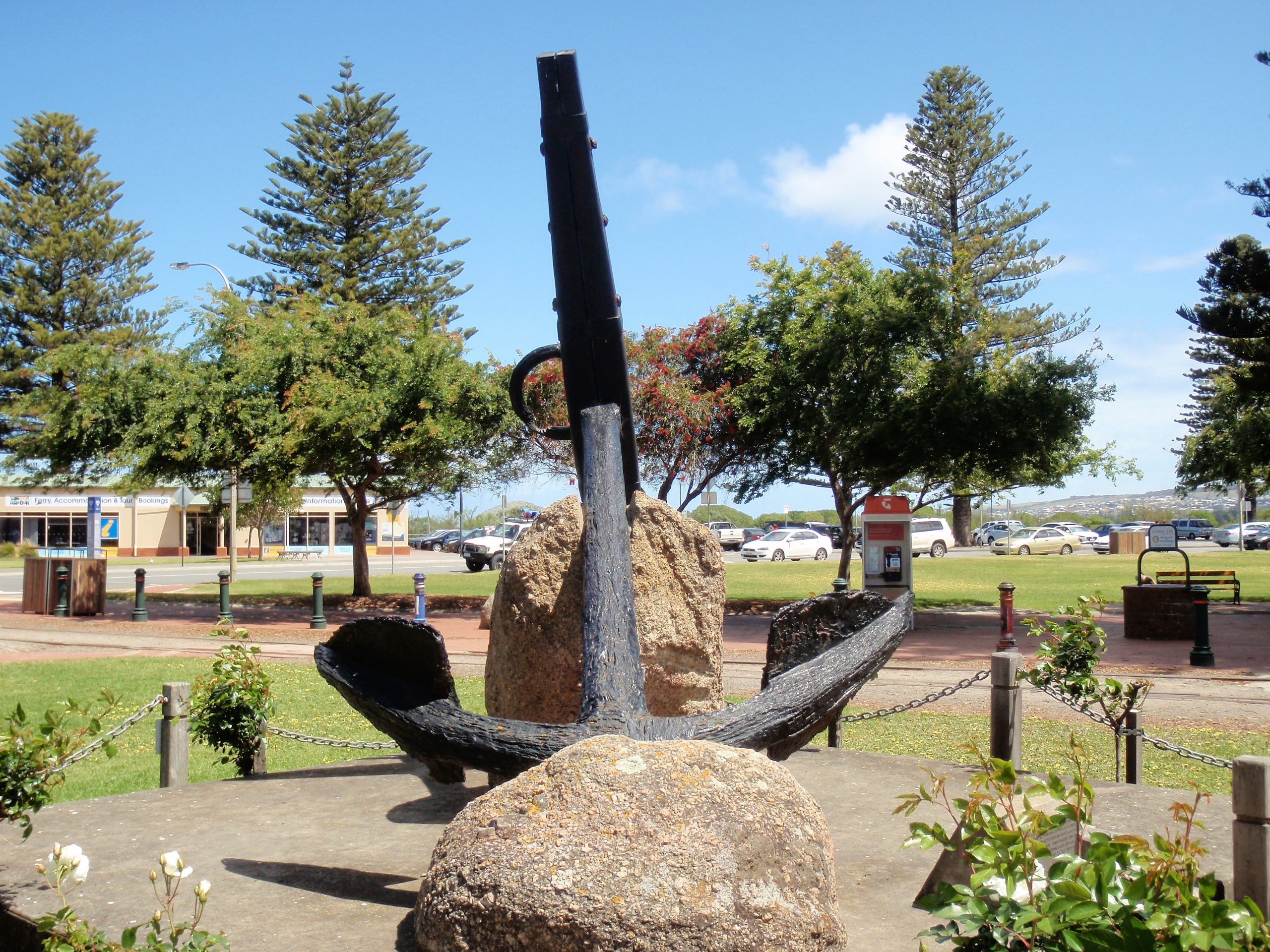
A large, stocked anchor thought to be from the 1837 shipwreck Solway is located by the entrance to the National Trust Museum at 1 Flinders Parade, Victor Harbor.
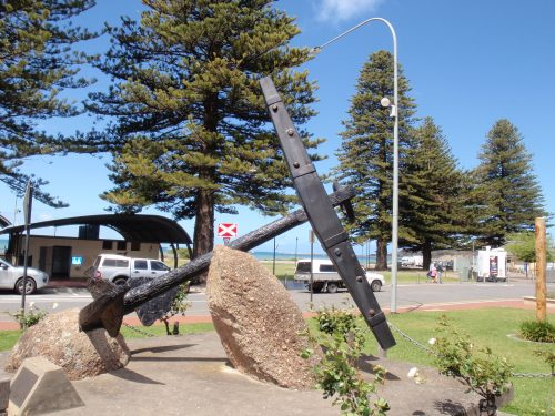
The Solway anchor at the entrance to the National Trust Museum
The 337-ton*, 3-masted wooden ship (brig or barque) Solway was wrecked in Encounter Bay in December 1837.
* (337 tons displacement, Old Measurement)
There is a commemorative plaque beside the anchor from the Solway: –
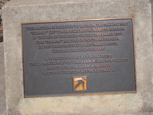
The commemorative plaque beside the anchor from the Solway
The plaque says that the Solway brought the first German migrants to South Australia in 1837.
There is no indication regarding just how the anchor was recovered from Encounter Bay and preserved for display. This additional plaque is the only clue: –
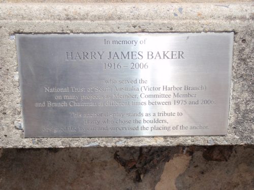
The additional plaque beside the anchor from the Solway
An annual report for the South Australian Museum Underwater Research Group (1962-1963?) states that the anchor was recovered by the South Australian Museum Underwater Research Group during that year (1962-1963?). Numerous whaling relics are said to have been recovered along with the anchor. All oif these items are said to have “been set up as an exhibit at the “Whalers Cottage”.”
I don’t know just where the “Whalers Cottage” was, but “Whalers Way” was (to me) located along the road to The Bluff at Victor Harbor, and whaling relics used to be on display there.
There is an anchor on display along the road to The Bluff, but that anchor is thought to be from the wreck of the South Australian.
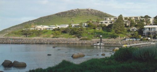
View of the road to The Bluff
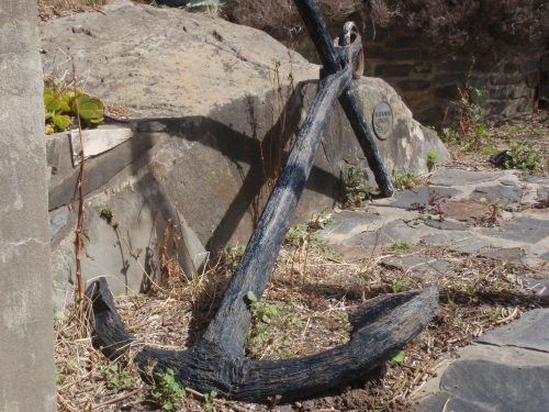
The South Australian’s anchor
According to the signage alongside the anchor, “A stocked anchor on display by the road to The Bluff at Victor Harbor thought to be “probably from the ‘South Australian’ (which) was recovered from the sea-bed where the ‘South Australian’, ‘Solway’ and ‘John Pirie’ were anchored in 1837”.”
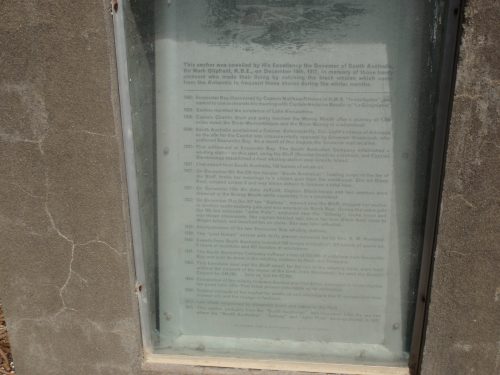
The signage alongside the anchor
As stated at the beginning, the anchor from the Solway is located by the entrance to the National Trust Museum at 1 Flinders Parade, Victor Harbor. It is a very large anchor, and just how it came to be placed in that location is unknown to me other than what is stated on the accompanying plaque: –
“A project funded by Young Trust*, the Lions Club of Victor Harbor and Port Elliot,
and the Victor Harbor branch of the National Trust of South Australia.”
* (Junior section of the National Trust?)
I only hope that there hasn’t been any confusion between the anchor at The Bluff and the one at the National Trust Museum. In other words, the anchor at The Bluff is not the anchor recovered by the South Australian Museum Underwater Research Group, but rather that the anchor at the National Trust Museum is the one that they recovered.
According to “Conserving Our Historic Shipwrecks”, 1987 (SA Dept. of Environment & Planning, State Heritage Branch), the Solway is a shipwreck “declared under (South Australian) Historic Shipwrecks Act 1981”: –
“Solway (1829-1837)
The Solway was a three-masted wooden ship built in Sunderland, England*, in 1829. She measured 103 feet in length, 27.3 feet in breadth, 19.5 feet in depth and was of 337 tons displacement (Old Measurement).
* (By John Storey, Monkswearmouthshore (near Sunderland).)
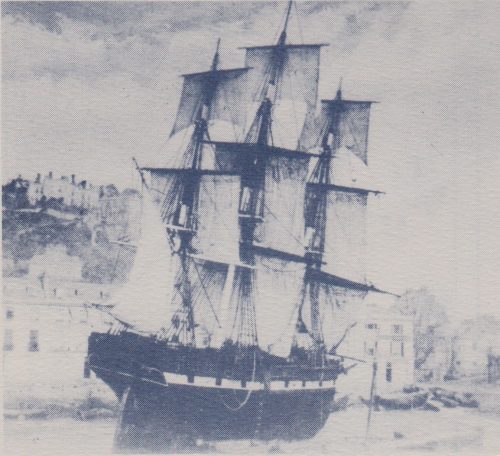
A vessel said to be of similar size, rig & age to the Solway
(Source: “Conserving Our Historic Shipwrecks”, 1987, SA Dept. of Environment & Planning, State Heritage Branch)
The ship left Hamburg, Germany, with 52 German immigrants and arruved at Rosetta Bay, South Australia, in December 1837. She anchored near the site where the South Australian had been driven ashore and wrecked a few days earlier, and while there was caught by a strong southerly gale. She dragged her anchors and was driven ashore on 21 or 22 December, being totally wrecked. At the same time another vessel, the John Pirie, was blown ashore but was refloated later.
The wreck is located on a sandy patch 150 metres inshore from the face of Blacks Reef in 3-4 metres of water. The remains consist of approximately 25 metres of the ship’s keel and keelson with one mast evident, and tere are about 5 metres of ceiling planking and frames either side of the keel. Copper bolts protrude along the keelson and throughout the wooden frames. Some rigging remains are located nearby as well as some copper sheathing, nails, ceramics and glassware. The remains aremostly covered with sand. Further ot to sea, bricks are strewn on the seabed together with one of her anchors.”
Mind you, that description was done at least 27 years ago as at 2024.
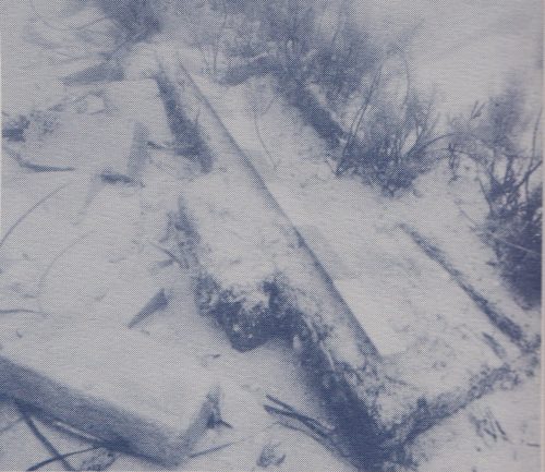
The wrecksite in 1983
(Taken by Bill Jeffery)
(Source: “Conserving Our Historic Shipwrecks”, 1987, SA Dept. of Environment & Planning, State Heritage Branch)
I have recorded the wreck’s coordinates as being -35.583965, 138.602189.
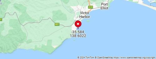
Map of the wrecksite
The South Australian Company was the owner of the Solway (registered in London) at the time of the wrecking.
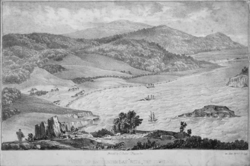
A lithograph of the wrecking of the Solway & the South Australian
(Source: [Pearson, Robert (Captain)], fl 1836-… | Items | National Library of New Zealand | National Library of New Zealand (natlib.govt.nz) Bragg, G F, active 1830s. [Pearson, Robert (Captain)], fl 1836-1840 :View of Encounter Bay with the fisheries. [Drawn by Captain Pearson] On zinc by G. F. Bragg. 7 Thavies Inn [Holborn, London]. Printed by C. Chabot, [December 1838 or January 1839]. Ref: A-096-047. Alexander Turnbull Library, Wellington, New Zealand. /records/23149920 ) )
According to the decription, “A view looking down into a bay near Adelaide, with huts* and houses, including fishery buildings on the shore, and three ships between two small islands and the shore. One ship, the three-masted Solway is shown wrecked on a reef. One, probably as the two-masted John Pirie, is sheltering alongside Wright’s Island. The third, probably the three-masted barque South Australian, is beached in the background close to the shore.”
* (One of the huts in the picture is said to be “Solway’s hut”.)
According to the attribution, the picture (lithograph) “Was attributed by the (National) Library from the time of accession in the 1980s until 2010 to William Light on the basis of its similarity to A-096-048, which appears to be from the same publication. However the style appears more naive than that of Light, the topography is not accurate, and there is no known original attributed to Light for this image. A hand-coloured copy of a later state of the same print on sale at The Antique Print Room, 455 George Street, Sydney, 2009, includes a printed statement, lower left, beneath the image, absent from the Library’s copy: ‘Drawn by Captain Pearson’, probably Captain R Pearson of the Solway, wrecked at Encounter Bay in December 1837
This is a more recent photo of the location in Encounter Bay: –
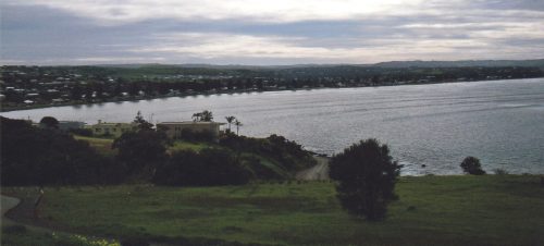
The difference in the background between this photo and the above lithograph is explained in the above Attribution by “the topography is not accurate”.
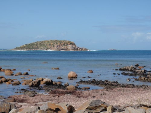
View of Encounter Bay (looking towards Wright Island)
(Blacks Reef is at top right)
Several unsuccesful attempts were made to refloat the Solway and it became a total wreck.
Hi there
I was with the Aqualung Club Of SA in the 1960s. We dived in the Bluff area a few times and watched each other from the verandah of the Whalers Cottage, then located at the southern end of what is now the Whalers Seaside Dining, 121 Franklin Pde, Encounter Bay SA. I don’t know when it was demolished.
I have a photo of the group under the verandah.
Regards
Jeff Catchlove
Hi Jeff, that’s wonderful, thanks. Can you please send the photo to me if it’s ok to share it?
Cheers Steve
Steve
Interesting article. I guess similar ambiguity exists across other salvage/wrecks.
Does this mean a deeper dive into the history of the ships to discover more about their anchors or is it likely to be relegated to ‘we will never know for sure’?
Keep the articles coming.
Thanks JJ, I’m doing my best to unravel some of the questions. Cheers, Steve