40 years ago, back in 1983, there was no Internet whilst I was the Editor for our Society’s newsletter. I still could have done a little more research towards the April issue of our newsletter that year though.
An elderly relative told me a tale about how a fish tagged in one of the Mount Gambier sinkholes around 1950 was later found in the Blue Lake.
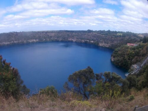
The Blue Lake
In my haste to use this information in our newsletter, I didn’t even make mention of Mount Gambier at all. I even got the name of the sinkhole wrong! I probably didn’t know very much about the Blue Lake back then either.
My version of the story came out as follows: –
“Over 30 years ago(,) fish were found in a pool deep down in ‘Humperson’s Cave’ in the Sth East of SA(.) The fish were tagged and one of them was later caught in the Blue Lake. This would indicate that caves and lakes in the Sth East are connected.”
I’ve no idea just how that fish was actually caught in the lake, unless fishing was allowed there back in the 1950s.
I was reminded of my lack of knowledge when I revisited Mount Gambier recently. It seems that ‘Humperson’s Cave’ is actually Umpherston Sinkhole (or cave). Our present day Internet allows some limited research on the topic, but little can be found regarding the occurrence of fish in either the sinkhole or the lake.
Umpherston Sinkhole (or Balumbul) was originally a cave formed through dissolution of the limestone. It became a sinkhole when the top of the chamber collapsed. I found this photo of boating in water in the sinkhole on YouTube: –
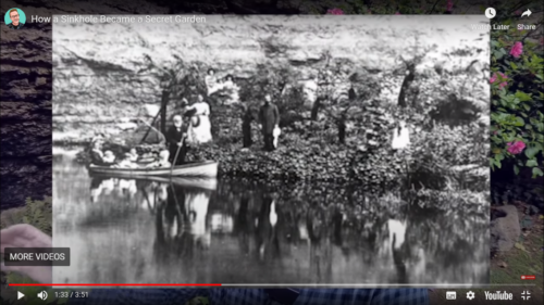
Boating in water in Umpherston Sinkhole
(Source: YouTube https://www.youtube.com/watch?v=kBoAfPJnbPg)
According to Lonely Planet, you could row a boat around in the bottom before the water table dropped some years ago, after an earthquake.
According to https://www.uncharted101.com/mount-gambiers-famous-blue-lake-a-world-wonder/ , “The land surrounding Mount Gambier is densely rich is limestone, due to the remnant of a shallow sea which lay over the region millions of years ago. This limestone, made up from fossils of fish and coral, forms a crust under the earth which extends for over two hundred kilometers (sic) and reaches a maximum depth at three hundred meters (sic) at Port MacDonnell, a small fishing town nearby. Over the years, this abundance of limestone has gradually been worn away by the ever flowing water table and has created an immense system of caves and underground cavern, providing a beautiful sight for divers. Mount Gambier’s Blue Lake is actually situated in a dormant volcanic crater and lies over fifty meters (sic) below ground level.”
I feel that water in the sinkhole probably disappeared almost entirely due to it having been used as a rubbish dump for some time, and the gradual build-up of plant life in there.
I found this photo of the sinkhole in the RAA’s 1983 book titled “Touring the South East”: –
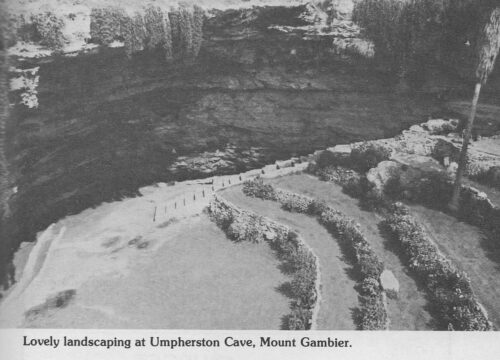
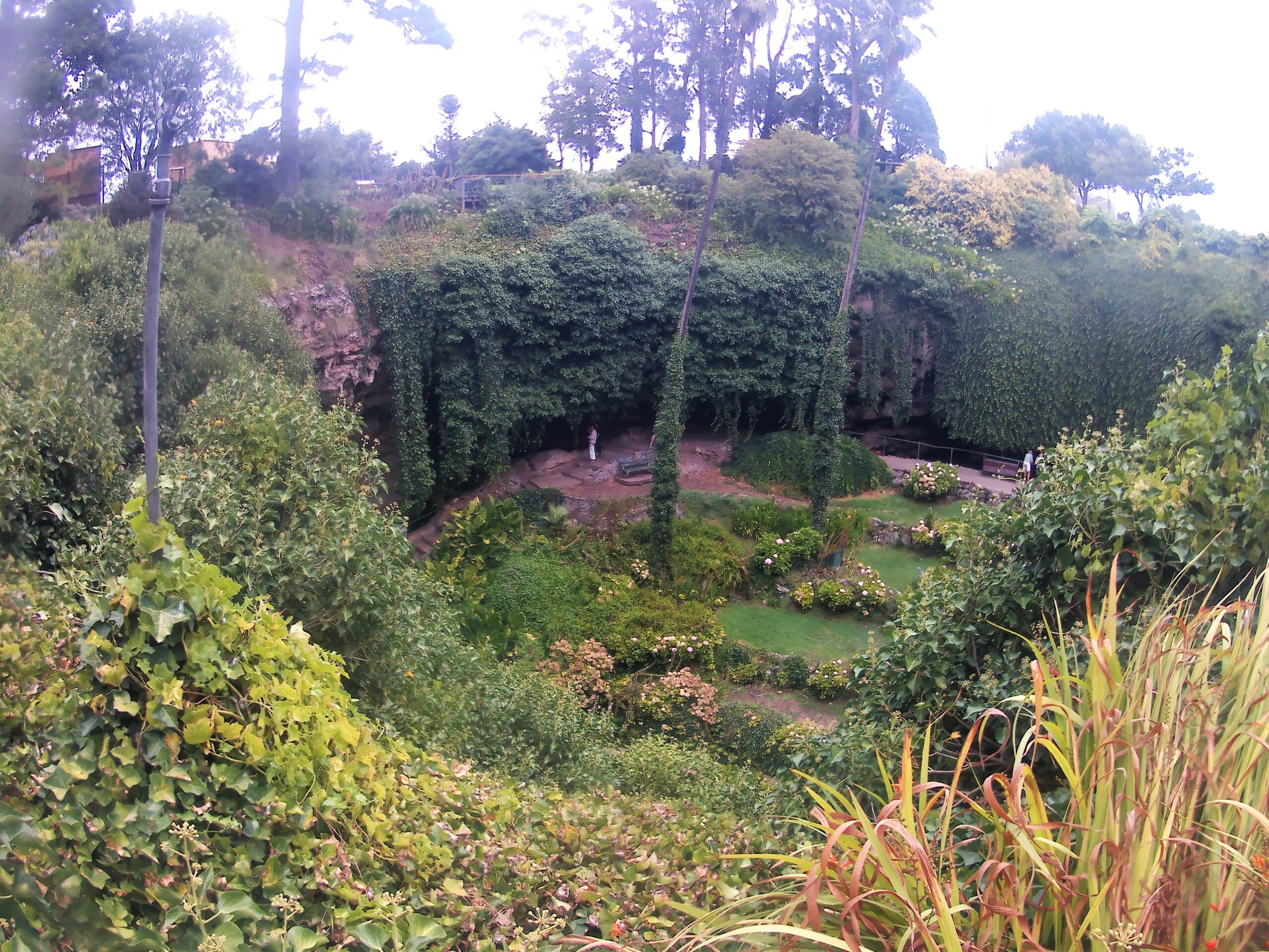
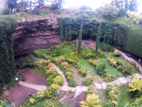
It seems to show a reasonable amount of water around the lowest point of the sinkhole. Note the amount of clear space and limited plant growth at that time. Compare it with this photo taken on my recent visit: –
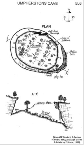
Peter Horne says that he got to a depth of around 5 metres in Umpherston’s Cave in 1982 (see further below).
Umpherston Sinkhole is approximately 3kms NE of the Blue Lake (as the crow flies). The tagged (freshwater) fish from the sinkhole must have been able to swim that distance under the streets of Mount Gambier, as they existed around 1950 onwards.
D. Darian Smith took this aerial photo of Mount Gambier’s crater lakes for the 1969 book “South Australia From the Air”, edited by Michael Williams: –
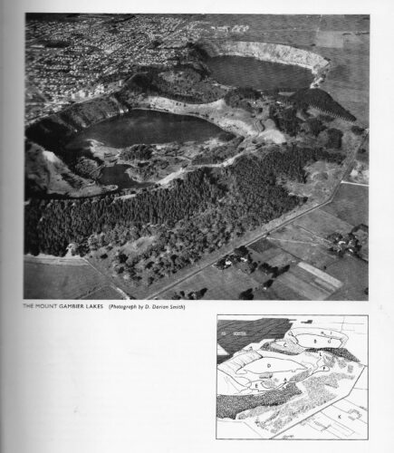
Umpherston Sinkhole is located beyond the top left of the photo. If you can read the key at the bottom of the page, B=the Blue Lake, C=Leg of Mutton Lake, D=Crater Lake, E=Browne Lake, F=the Punchbowl.
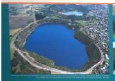
Below is an aerial shot of the Blue Lake, as featured on one of the information boards of the interpretive centre at the Blue Lake: –
Peter Horne says, “Looks like just another of the many Mount Gambier/Blue Lake myths to me…! The only fish known in Blue Lake to date are “native trout” (Galaxias sp., probably G. maculatus), but how they got into the lake is not known. Same with syncarids which I was shocked to find at a depth of around 40 metres there during a night dive!!! We also recorded the deepest yabbie capture in SA, found on the outside of a trap recovered from right in the middle of Blue Lake, around 77 metres or so.
“Before the mid-1980s renovations which finally filled in the deepest areas of the sinkhole, I did a couple of no-mount (hand-held) dives in what little water remained in Umpherston’s Cave in 1982; I got to a depth of around 5 metres before the fissure pinched off to inaccessibly narrow. But I could see that it continued on, so who knows what lies between the sinkhole and Blue Lake?”
Peter kindly sent me these two plans of the sinkhole: –
My thanks go to Peter Horne for his assistance.