Members of both groups attended a Green Adelaide-sponsored, Mudflat Monitoring Workshop at West Beach on the evening of 15th September, where researchers from Flinders University, including the current President of the Royal Society of South Australia, Professor Sabine Dittman, handed out hard copies of a draft Mudflat Monitoring Manual for Citizen Scientists and were seeking feedback from stakeholders, including Friends of the International Bird Sanctuary. Feedback on the night included the need to manage risk; informing the relevant park manager prior; use of a hand lens to improve identification of critters; spreading the sampling effort; developing less invasive methodology; and refining the technique for measuring and describing sediment particle size.
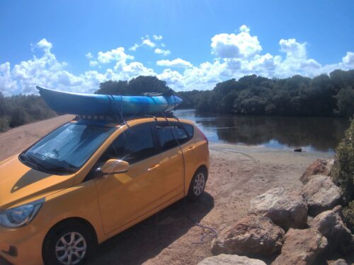
Life is a journey, not a destination and as the day approached, we did some research on tides and orientated ourselves with maps and consulted books on mangroves and samphires and the birds of the Adelaide International Bird Sanctuary. As we passed the Riverlea development we were reminded of the development pressure that is increasing in this part of the Gulf. As we turned off the Port Wakefield Road, we passed extensive horticultural growing areas. We travelled through salt ponds full of brine shrimp, with the ubiquitous “Jurkovic Group” signs around. As we alighted our vehicles in the car park at the end of Port Gawler Road, we could hear the public announcer and the vehicles using the offroad park, which is a bit further north. Finally, it was good to be back out among the tidal wetlands of the samphire coast, when everything else just fades away.
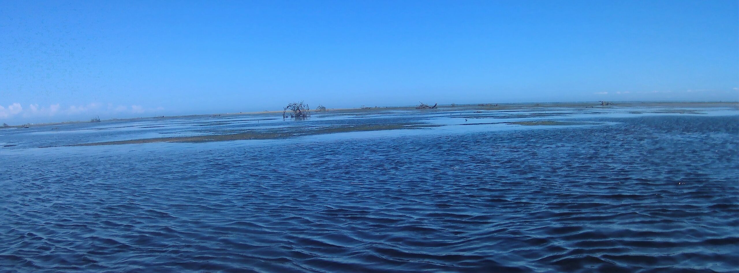
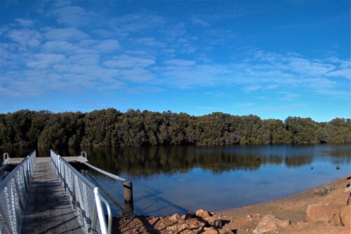
Members from both groups set out from the landing at Port Gawler at approximately 11:45am and it took approximately twenty minutes to paddle out to the mudflats west of the mangrove-lined riverbanks. We were not alone on the flats with fishers, crabbers and touristy types all paddling out at around the same time, which was about 1 hour before low tide. Our intention was to paddle out to a suitable bare and muddy bank, where we could beach our kayaks and simulate sampling. The Adelaide International Bird Sanctuary was not informed of our presence because it was our intention to take nothing but photographs and leave nothing but footprints. It occurred to us that if everyone sampled the first muddy bank, they came across there would be a lot of footprints. Maybe the citizen science sampling effort is to be concentrated in areas with closer connection to the land because extensive areas of mangrove and Zostera seagrass beds, interspersed with deeper channels would make access to some of the offshore mudflats difficult, even though concentrated effort could be considered a form of researcher bias.
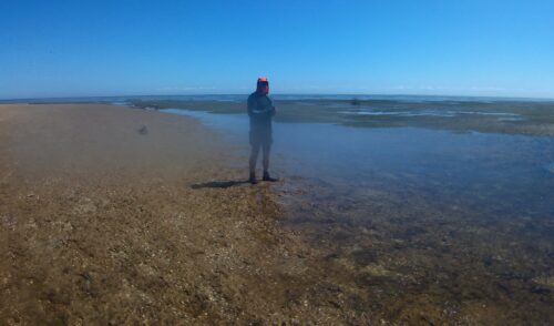
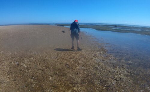
We visited two mudbanks. One mudbank was well-sorted and mostly fine sand and very fine sand, and possibly some coarse silt – not sure if it constitutes a mudflat per se but we definitely saw evidence of the biota that the mudflat researchers are interested in. We did not take a quadrat, but we saw evidence of burrows, mound burrows and tracks. There were no living molluscs on the surface of the sand, and we didn’t dig down but there were some shelly fragments at the surface and from the mound deposits, we inferred that the anoxic zone was not too far from the surface – maybe less the 30 cm. The second sand bank was composed almost entirely of shelly material with the species diversity you might expect in this locality but with immense abundance. It was difficult to determine how deep the shelly layer extended down, where the anoxic zone was, or whether there were any burrows because we did not dig but we inferred a different subsurface ecology. In between, we observed areas of Zostera muelleri closer to the surface and Posidonia sinuosa in the deeper sections. There were occasional Posidonia australis leaf blades that must have floated in from further out. There wasn’t much Ulva sp. on the pneumatophores, and we surmised that may because the nutrient pollution might be diluted this time of year, but we did observe an abundance of Gracilaria sp. on the pneumatophores, and we wondered if that might be seasonal also.
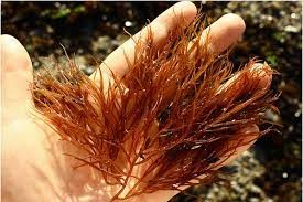
Gracilaria sp.
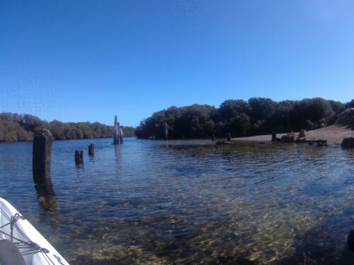
We thought about the risks involved in getting to these locations on kayaks (always in pairs) and whether an emergency management plan might be warranted, just in case. We thought about the risks and returns of using other methods to access mudflats and whether the research extended far enough out into the Gulf. On the way back to the pontoon, we explored some of the tidal creeks and an apparent shipwreck. We spoke briefly with other groups that were out on the water on that beautiful sunny, first day of the October long weekend, and we contemplated what the rest of the crew were up to. Next time, we might kayak further south to the Bolivar outfall on an appropriate tide and take some water quality readings – maybe over the summer months.
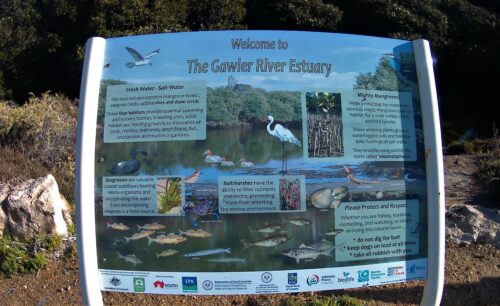
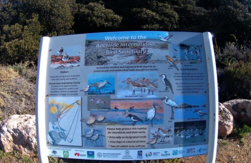
Here is some interpretive signage from the area: –
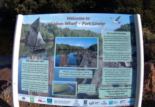
(According to, Port Gawler Conservation Park | VK5PAS
“Port Gawler was subdivided into various allotments with the street names, named after the Spanish campaign of General Wellington (of Waterloo fame). In 1869, the ‘Lisbon’ wharf and Waterloo Road were constructed.”)
Excellent account thanks Mark.
Seems that digging is a future priority, in addition to resolving all the issues you have mentioned including risk management, site selection etc.
I missed a fun educational day in kayak and on mud flats!
Loved reading this, soo good